Exploring the Jadung Valley and Nakurche Dhar
 |
| (The guesthouse by the banks of the Bhagirathi at Uttarkashi) |
The guesthouse was by the riverside. The one thing that
rankled in the mind was the sudden increase in water levels that evening. I
thought it must be the usual melt-water swell of the evening. But the early hours of next morning proved
the theory wrong. There indeed was precipitation upstream or some seriously heavy
snowmelt.
Day01-
Uttarkashi(1100M)-Jadung(3650M): 125Km Drive, 6Hrs
With a mild drizzle providing us the wet cover, we started
off lazily, at about 9 in the morning of 2nd June, for Jadung. Soon the rain gave way to a
dazzling sun and after a pleasant drive we were at the gateway of the Nelang valley by 1400 Hrs.
 |
| (The new signages at the entry to Nelang watershed. The old board, bottom left, that got destroyed in the heavy winter snow of early 2013) |
All but few of the gang-huts lining the entrance to Nelang the previous year had gone. The
Blue-Red board of the district police had been destroyed in the massive winter
snowfall. At its place now, announcing dire consequences for trespassers, was a
new board erected by the administration.
After the thrilling drive through the gorge country of the
gateway of the Jahnavi watershed, the
landscape widened out gradually even as we approached the Nelang Post. After some
minor formalities with the post-commander we proceeded forth, seeing Naga and Do-Sindhu Bridge enroute.
Finally reached Jadung around 3 PM –
just in time to negotiate another administrative hurdle.
 |
| (Camp at barren fields of Jadung. Village and post in background) |
By about 8 O clock in the evening the official hassles were
sorted out and the day ended with a nice and warm campfire in the wide-open
fields of Jadung. The little
solar-powered lights of the ITBP post shone at a distance across a little
stream. The silhouettes of the ruins of the Jadung
village above the post created an ambience that was surreal and ghostly.
With the biggest hurdle of red tape out of the way, our
minds now focused on the easier part of the adventure, the expedition that was
to start next morning.
According to the plan, we were to reach Janak Taal in 2 days time. We had to find a campsite between Jadung and Janak Taal.
“एक camp site है 3
kilometer आगे . Lal Devta (लाल देवता) camp site.लेकिन 3 Km मैं camp लगा के आपको फायदा नहीं होगा".. The soldier was pointing towards the serpentine bend in the
valley ahead.
Day02- Jadung(3650M)-Bharal Kill
Point(3950M): 7.5Km, 6Hrs
We started off with an open mind to look for campsites on
the way.
‘Whichever is the next possible campsite after Lal Devta, we camp there”, Vinod and I decided together.
 |
| (The lovely Laldevta Camping Ground) |
After a steady climb and a reasonably fast descent we
arrived at the lovely camping grounds of Lal
Devta. The Jadung Gaad curves in
from the west here with a wide bed and a giant bend. The campsite has two large
terraced plains with an abundance of grass and shrubs with yellow flowers. At almost the middle of the ground, there is
an ancient place of worship and nearby are remnants of shepherd shelters.
The route rises steadily thereafter to a raised plateau well
crafted into tracts of terraced fields. Towards the east almost on the high
right bank of Jadung Gaad was a small
temple with some figurine inside and a timeworn brass bell.
 |
| (Reaching the Laldevta shrine area) |
Ahead was a glen with a fast-flowing stream, coming in from
the high glaciers to our left and beyond that the route rose sharply above
leading to another rocky shrine with red pennant atop fluttering capriciously.
We had reached the Lal Devta shrine area.
Even while we were catching up on our breath and regrouping,
we could see an ITBP party up above
near the red pennant beyond the glen. They were a group of 7 odd men who had
gone to drop load at Janak Taal in
the morning at about 0600 Hrs. They were already on their way back to the post
and it was only 1030!!
 |
| (Crossing Laldevta Nala and reaching the rock temple of Laldevta) |
We waved at each other from that distance and then proceeded
ahead to meet with them, while crossing the fast-stream in the middle of the
glen. As we crossed each other near the stream, they shook hands and wished us
luck. Few of them handed over some tasty orange flavored chocolates and some
packets of fruit juice.
 |
| (Rock temple of Laldevta where we saw the nest of Bumble Bees) |
After the tiring climb to the rocky shrine we regrouped. Arun managed to take some fantastic HD-footage
of a nest of bumble bees here.
 |
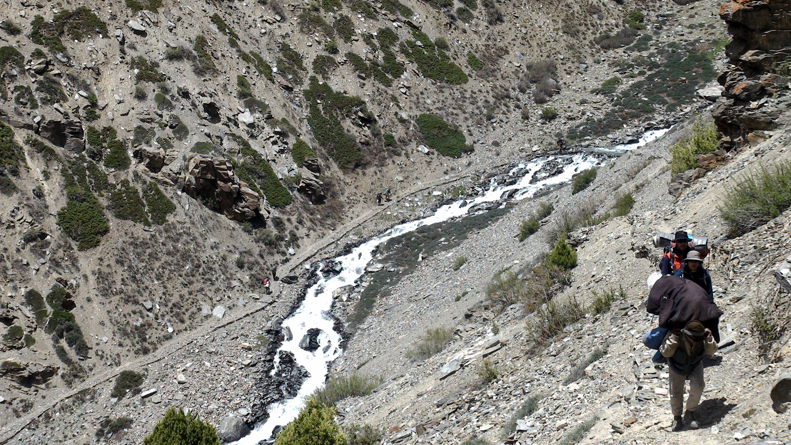
| (The Jadung-Janak Taal trail ahead of Laldevta area) |
About two hours later Vinod
and I were still looking for a suitable campsite. Kuntal and Anant were the
advanced scouting party and they reported of a possible campsite by the
riverside.
 |
| (The Bharal Camp near the snow-bridge- 3 Km from Janak Taal) |
As the team approached the campsite a strange and ghastly
scene awaited us. Right in the middle of the potential camping area, there was
a carcass of a Bharal. It appeared as
if a predator had killed it. Closer scrutiny revealed fatal teeth marks on its
neck. One side of its face was eaten up
and there were signs of scavenging on his stomach.
 |
| (The half eaten Bharal carcass) |
“लेकिन चीता ऐसे खाता है क्या?” I asked
“ ऐसे तो भालू ही खा सकता है”..Quipped one of the Nepali
porters.
Soon we established that the dump of black colored stool
near the carcass actually could belong to a bear.
It appeared as if the animal was killed by a leopard but had
been eaten up partially either by a pack of dogs or by a bear. The sequence of
events that led to the misfortune of the poor animal could not be ascertained
for sure. One thing was clear. More than one predator, not belonging to the
same species, ruled the area.
We took extra care that night to discourage
local carnivora by lighting up small fires near the camping area. It was our
first night on the trail. The team was bonding yet. The tiredness of the first
day’s toil hit us soon. The constant
rumble of the rolling stones in the river nearby, the proximity of ferociously
flowing waters and the constant fear of the unknown Bharal-hunter did not allow a sound sleep that night.
Day03- Bharal Kill Point(3950M)-
Janak Taal(4120M): 2Km, 2Hrs
 |
| (Starting off for Janak Taal from Bharal camp) |
At 1100Hrs we entered a wide-open amphitheater with a spectacular setting.
 |
| (The bridge over Jadung Gaad near Janak Taal The ITBP recee route on the true left of river near center frame) |
As we proceeded further we could see the origin of the
clear-blue stream. There it lay, nestled cozily between two mountainsides, an
aquamarine blob of nature’s marvel- “The
Janak Taal”.
When we saw it for the first time, each one of us was
wonderstruck by the vibrant blue of its waters, as if someone had accidentally
constructed an Olympic-swimming pool
in the wrong place.
 |
| (The beautiful Janak Taal) |
Initially we thought it was the color of the sky that was reflecting
on the waters. By evening, as the sun traced it route on the sky above, the
theory was soundly disproved.
While it was difficult to even spot an insect or a butterfly
at that altitude, the porters noticed a pair of dark objects swimming in the
middle of the lake. The mystery was unraveled in the next 15 minutes when the Nepali porters actually managed to catch
the object of our curiosity.
 |
| (The Northern Pintail swimming graciously in the Janak Taal) |
Constantly flowing water in the stream emanating from the lake indicated that there was a source of water somewhere which poured into the lake. Soon we discovered the water source at the far end of the lake. There was a large rock from under which crystal-clear spring water emptied into the Taal.
 |
| (The spring that pours crystal clear waters into the Janak Taal) |
That explained it! The dead glacier to the west of the Taal had an subterranean flow of glacial melt which appeared as the spring. Because of the underground flow, the melt water was automatically getting filtered of the sediments before being accumulated in the Taal.
No wonder, it was a place of pilgrimage of the Jadh people in the days of the yore. The combination of features that nature has on display at Janak Taal would have appeared nothing less than magical to the simple Jadh community!
 |
| (The Janak Glacier, with the patch of snow, at far end of Janak Taal) |
From here on our path departed from the well laid out track
of the ITBP patrolling route. The camp-load that the ITBP team had dumped the
previous morning rested right near the entrance to the Janak Taal area. They would be moving in soon because of a
classified exercise that the forces were undertaking in the entire Nelang watershed at that time.
 |
| (The Shakti Temple on near end of Janak Taal) |
Exploring the area near the lake we found an old little
temple with figures of goddess “Durga”.
Nearby was a pile of flat rocks upon which was inscribed some prayers/writings
in the Tibetan script. These were “Mani”
prayer-stones which had the
inscriptions saying “Om Manipadmeham
Namah” in Tibetan script.
 |
| (Old Mani Stones near Janak Taal) |
We took pictures of the inscriptions, which could perhaps be
deciphered by our Tibetan friends in Delhi.
Some of the newer plaques were written in Hindi
but a majority of inscriptions were in Tibetan.
The recee team came back at 1500Hrs. Their report wasn’t
encouraging. They had climbed about 5 Kms up and had dumped the loads at a
rocky flat. But the issue was, they had not found any water source. Apparently
the entire glacier was a dry desert. We took hope from the fact that there were
patches of snow, which we could possibly melt and run the kitchen.
 |
| (Panorama of Janak Taal camp area- pic by Kuntal Joisher) |
As the evening wore on, the rumble of the rolling stones in
the Jadung Gaad nearby grew louder
and stronger. That night, it was a mixed bag of emotions- the joy of finding
this paradise called Janak Taal and
the apprehensions in our mind for the route ahead in the barren Janak Glacier.
Day04- Janak Taal(4120M)- Tower
Peak Camp(4600M): 5Km, 5Hrs
 |
| (The sharp ascent into the Janak Glacier) |
While scanning the satellite maps, we had earlier noticed
two glacial ponds of considerable size in the middle of the glacier. One of these was in the center of the medial
moraine and the other close to the rock face on the true left of the glacier. I
hoped to find one of these water sources so that we could go easy on fuel consumption
in these early days of the expedition. Melting snow meant additional
consumption of fuel.
 |
| (Water at last! Camp 01 at the feet of the dark rockface.The team gathering near large snow-patch at bottom center indicates the location of the rocky camp site) |
Soon we reached the site where the loads had been dumped the
previous afternoon. We still had not found water!
“दादा दादा! पानी मिल गया .. rockface को लग के है ..” crackled Kuntal over the radio. Kuntal and Anant had struck water just about 200 Meters ahead on the true left
of the medial moraine near a craggy rockface. The sat-image data was correct!
With the biggest problem of the
day out of the way, we went about setting up our first rocky camp on the barren
moraine of the Janak Glacier.
 |
| (Anant Khirbat praying for good weather with Tower Peak in backdrop) |
We had made good progress for
the day; 5 kms deep and 500 meters high into the Janak Glacier. The altimeter read 4600 Meters.
On to the true right of the glacier just
opposite to our campsite rose a tall rocky tower capped with snow. The striations
of the rock strata towards the top made it look like a smaller replica of the Holy Mount Kailash. For a rock climber
it surely presented an interesting challenge.
Day05- Tower Peak Camp(4600M)-
Jadung Kund (5050M): 3Km, 3Hrs
 |
| (Crossing the junction where glaciers from North and South col of Nakurche Peak meet) |
About a kilometer ahead of the junctions as we proceeded
towards the South Col of Nakurche, we
came across a large glacial pool, located close to the true left of the
glacier. We called this Jadung Kund,.
We had already crossed the 5000 Meter mark. It was time to set up camp, our
first snow camp!
 |
| (The Jadung Kund camp- Base camp at 5050M) |
The route ahead was through a vast snowfield with an easy slope. In the middle of it was a baby stream flowing silently. About a kilometer ahead the valley bent towards the right rendering the Cwm of the glacier invisible. But we estimated no more than 3 hours of walk to reach the head of the glacier where we could setup the Advanced Base Camp.
Day06- Jadung Kund (5050M)-
ABC(5300M): 2Km, 2Hrs
We decided to setup an advanced
base camp at the terminal part of the Cwm of the glacier form where we could
carry out a simultaneous reconnaissance of both the Nakurche South Col as well as the Nakurche Peak.
 |
| (Route ahead of Jadung Kund camp. Cwm of glacier not yet visible) |
The gently rising snowfields led
us to the head of the Southern head
of the Janak Glacier. After a friendly snow trudge of about 2 hrs we set up camp
near a half frozen large glacial lake at 5300 Meters. We called the lake "Jadung Taal" and found a rocky patch on its high bank to set up
camp.
The South Col and the Nakurche
Peak were almost directly overhead to our left and right respectively.
Their imposing presence had an overwhelming aura over the camp all the while.
 |
| (Panorama @ head of Janak Glacier. South Col seen as prominent depression @ left frame. The easier ridge towards right frame defines the summit ridge for the Nakurche peak- the prominent hump at center frame) |
The South Col and the route to its top were looking dangerously steep.
Towards our right, the route to the top of the summit ridge of Nakurche wasn’t looking easy either. It
was already the 7th of June. Bad weather was closing in fast and we
had to be off this high place within the next three days- either exiting from Chorgad, over the South Col or back the way we came.
Day07- ABC(5300M): Recon of South Col (5500M) & Ridge (5800M)
The quartet of Vinod,
Janak, Lakhpa and Rajender left
for a reconnaissance early next day, which opened, sunny and bright. Vinod and Rajender went for the col, and
the other two for the summit ridge.
 |
| (Team leaves for the recee of the route to South Col and Nakurche Peak) |
After about an hour the party for the col radioed back their successful climb from the top. Vinod reported the conditions for descent to Chorgad.
“90 degree का slope है sir. .. loose rock है. Load के साथ rappel करना risky है. Porter के लिए दिक्कत हो जायेगा.”
“आगे सुन्दर meadow है … valley दिख रहा है.. बरफ कम है…" he went on describing the descent
into Chor Gaad valley.
“कोई बात नहीं, आ जाओ. Peak attempt करेंगे ..” I radioed back.
 |
| (View west of the South Col. The flat ground after sharp descent visible in the foreground defined the white snows; Pic- Vinod Panwar) |
It is always better to
be in a known valley in unsafe weather conditions. I decided to attempt the
peak and then retreat back to Jadung
having accomplished the primary mission of documenting the Jadung valley, Janak Glacier and
the Nakurche Ridge to Chor Gad.
 |
| (The craggy top of the Nakurche South Col: Pic- Vinod Panwar) |
Janak and Lakhpa, the scouts for the summit ridge,
did not return for another three hours. Just when the clouds were rolling in
around the noon, both of them came back to the camp. They reported good news.
“ऊपर बरफ ठीक है. चौड़ाई भी ठीक है. एक rock है आगे। . थोडा difficult हो सकता है. रास्ता ठीक है ..” reported Janak.
“लेकिन कल जल्दी चलना होगा, 4 बजे. सारे rope up हो के जायेंगे”.. he warned.
Excitement was back in the camp. The apex challenge was
drawing near in the next 12 hours! Everyone was soon busy rounding up the
personal equipment like harness, carabineers etc. Vinod went busy for the next three hours adjusting and customizing
the harness fitments for everyone.
Day08- ABC(5300M): Rocky Pinnacle -Summit Ridge 5852M, 8 Hrs
 |
| (Starting off for the climb at 0400 Hrs from ABC- Jadung Taal camp) |
As we looked down along the ridge we could see the hump of
5750 meters at one extreme- the point that’s visible above the Jadung Kund camp. The top of it looked
like a perfect Helipad!
 |
| (View south from ridge top) |
“May be on another occasion”. I mused to myself :-)
The walk on the summit ridge of Nakurche is a painful one. One has to continuously climb up and
down the many small pinnacles that dot the summit ridge while having in view
all the while the steep slopes leading down on both sides. After about an hour of such arduous labor we
reached a tall rocky pinnacle of about 100 ft height.
“ यहाँ से down होना बहुत मुश्किल है. Down बहुत ख़राब है और risky है.” Vinod was on the radio
“Side से मार नहीं सकते?” I asked
“निचे जाना पड़ेगा. ऊपर से risky है” crackled back Vinod.
 |
| (Ridge walk on the summit ridge of Nakurche peak) |
“We go down guys. Some other time; may be from the North Col someday.” I told the team. We
were about 158 Meters below the summit and perhaps less than 300 meters away.
The customary cairn was setup and a puja was performed. The
team got busy for a while shooting the lovely panorama around.
 |
| (The pinnacle that offered the final and decisive obstruction) |
 |
| (The pass over the Northern Chorgaad Glacier at extreme left. Of the two Glaciers visible, the one to the left is Northern Chorgaad Glacier) |
In fact the Bushaheris stopped using the pass when around 1700 AD one such party of horsemen lost 18 lives in that snowfield, on their way back from Nelang and Jadung.
The pass over the North
Chorgad Glacier is not one such pass where a cavalry can crossover, nor
does it have a 5 days snow trudge in good season. At best one has to manage a snow trudge of 2 to 3 days in good season through that route- but never with a cavalry.
 |
| (View of South Col from ridge top) |
Such a pass exists at the North of the Dudhpani Nala in
Chor Gaad valley, which does
crossover a massive snowfield, the entire route characterized by a crevasse
ridden gentle slope, nowhere the gradient more than 25%. This route ends at the
snout of the Baspa glacier above the Gaundar Thach. That could also be the
reason why Hutchison mentions the
name “Gundar Pass” for the same
mountain-feature.
I hope to make it one of my expedition objectives in the
coming years.
Coming back to the lovely panorama one was witnessing, to
all along the right was the boundary of the Nelang
watershed that gave birth to the Jahnavi.
At the 2 O’ clock direction one could see the headwaters of Jadung Gaad, a highly inaccessible and
desolate place strewn with crisscrosses of myriad glaciers. Slightly to its
right were the extreme northeastern borders of Nelang- Thag La and Tsang Chok La(Jelu Khaga) barely visible.
 |
| (Hawa Mahal peak in foreground and Mt Leo and Reo Pargial in the backdrop) |
Straight-ahead, between Chorgaad
Glacier and the Jadung headwaters
the giants of Himachal- Reo Pargial and Leo Pargial were visible
and so was Rangrik Rang.
To the right and till the 4 O Clock directions a massive
rocky mountain adorned with many rocky spires blocked our view. We called it
the “Hawamahal Peak”.
To all of our left was a mesmerizing panorama. It was as if
someone had offered an amazing gift of a view of all the Garhwal giants in a single platter. The whole set of ranges
bounding the Upper Taknore Patti were
visible- Shrikanta, Gangotri, Auden’s
Col, Jogin, Thalaysagar, Bhrigupanth, Shivling, Meru, Satopanth, Chirbas, Deo
Parvat, Shri Kailash and far in the distance the Zaskar giants Mt Kamet and Mana.
 |
| (Panorama of Garhwal Himalayas from ridge top at 5850 mtrs) |
The campsite looked microscopic almost directly 2000ft
below. It was time to start back, remembering all the time the famous adage:
“Climbing is optional but descent is mandatory”.
The way down required a bit of rappelling and lowering down.
The sun was getting harder and the snow softer. After much struggle the entire
team took to glissading one after the other. All of us reached back camp safe
by 12 Noon.
 |
| (Team returning from the climb, seen as tine dots over the snow-slope) |
By evening it was clear that the weather was
indeed turning for the worse. The decision was clear- we had to exit the valley
as soon as possible before the rain struck with full fury predicted around the
13th and 14th of June.
Day09- ABC(5300M)- Janak Taal (4120 M): 10 Kms, 4 hrs
 |
| (The Nakurche peak, hump to the right, seen from the glacier junction) |
Around 1100 Hrs
while we were resting near the “Tower
Peak” campsite, we observed an interesting spectacle in the sky. There was a bright round halo around the
sun with all the colors of the rainbow creating a perfect circle.
 |
| (The strange halo around the sun seen near Tower camp at 1115 Hrs) |
While we were busy clicking pictures of this interesting
phenomenon, Joshi, one of the older Nepali Porters said,
 |
| (Negi checking out the halo around sun with binoculars mear Tower Camp) |
Only later we realized how correct he was when the freak
cloudburst over Kedarnath on 15th
June created the unfortunate disaster.
By 1300 Hrs we were ready to camp at Janak Taal. We were homeward bound and were in high spirits. The
lovely surrounds of the Janak Taal
only helped in lifting the team morale further.
 |
| (The bridge over the Jadung Gaad had been washed away when we reached Janak Taal) |
For some reason waters had risen. May be too much sun for a
whole week had created additional snowmelt at the headwaters of Jadung. In fact, meteorological data from NRSC (National remote Sensing Center) indicated that there had been unusually high rainfall in the higher reaches of the mountain during the period we were in the highlands of Nelang.
We had to hurry down quickly.
Day10- Janak Taal (4120 M)- Jadung (3650 M): 10 Kms, 4 hrs
 There were more evidences of flooding as we started on our
way back to Jadung. The trail had
gone underwater at several places before the “Bharal camp”.
There were more evidences of flooding as we started on our
way back to Jadung. The trail had
gone underwater at several places before the “Bharal camp”.
There were little remains of the Bharal carcass. Only some fur and bones were left. Whoever was the
predator had a hearty meal the whole of the previous week.
After the “Bharal Camp”
point, the route goes high up in the valley and consequently there was no
further obstacle from river waters till we reached Lal Devta.
 |
| (Remains of the Bharal carcass on our way back. We saw pug marks of a large cat around) |
The waters of the Lal
Devta Nala had also risen which necessitated a cold crossing, one in which
one had to take off shoes in order to wade through fast flowing icy cold water.
We spent some time regrouping at Lal Devta while some of us got busy capturing lovely pictures of a
flock of sheep ascending the mountain on the far side of Jadung Gaad.
One needs to catch up a bit on the Lal Devta shrine here which is set high above the river bank, on a
ridge of grass and rock. It seems the Lal
Devta has always been an important deity worshipped by the Jadhs. The shrine here is surrounded
with almost 3 acres of tillable land cut in terraces. There are some rocky
remains of some dwellings that perhaps could be housing the priest of the
shrine.
 |
| (The Lal Devta shrine of Jadung- 3 Kms from Jadung post) |
The seat of Lal Devta is
usually installed at a high ground. Even near Bagori, where the Jadhs live
today, they have erected a shrine for Lal
Devta, which one finds on the way up the Jalandhari Gaad valley, on a rocky clearing, high above the
river.
It seems thus that the shrine by whose side we were standing
that moment was the original shrine of worship of Lal Devta, which the Jadhs may
have used for many centuries.
We reached Jadung Post
in another couple of hours, just in time for a sumptuous lunch prepared by
the ITBP mess.
After the necessary briefing and paperwork telephone calls
were made to respective homes and logistics organized for the return to Uttarkashi the next day.
It was a moment of pride and a feeling of a strange
camaraderie when the Officer-in-charge of the post, most diligently, took down
the coordinates of key camping and observation points.
By that time we had come to know that no vehicle
can reach the last 5 Kms to Jadung
and we would have to trek to a “Jeep
Pickup point” next morning. Apparently the rising waters in the Nalas had destroyed the motor road at a
point 5 Kms away.

The team had a grand time watching a dance performance by the porters. Its an experience watching those hardy children of the mountain lost to the music of Nepali and Garhwali songs.
How easy for them to be happy with life, with so little of material comfort! I was wondering; watching old Joshi dancing away to glory, ice-axe in his hand, with a raging campfire providing all the light for shooting that absorbing scene.
Day11- Jadung (3650 M)- Uttarkashi (1100 M): 135 Kms, 6 hrs
 |
| (Age old structures with fine work on Deodar wood- Jadung village) |
It is a pretty little village set on the right bank of a Nullah that empties into the right bank
of Jadung Gaad. There are at least 30 odd houses in the
village. There was a temple almost near the entrance of the village and one
somewhere to the back of the village.
Most houses have a wooden structure filled in with mud and
slate. The roofs are wooden, covered with slate. Most houses have multiple floors,
the ground floor being reserved for use as a shed for the family livestock.
 |
| (Kalyani's sketch of the building at the entrance of Jadung post with fine woodwork) |
The remains of the life of a people who used to live there
could almost be smelt and touched. The pillars with fine woodwork, the cold
stoves, smokeless chimneys and the empty granaries told a story of a time gone
by. One still savors that feeling of nostalgic romance.
We had a final parting shot with the men of the Jadung post with a bright and proud Tricolor fluttering over our head. The post reverberated with a spirited shout of "Bharat Mata ki Jai"!
 |
| (Bharat Mata ki Jai! @ Jadung post with the men in-charge of the post) |
While walking that near virgin terrain, the thoughts went back to Jadung in a strangely nostalgic way. Somehow it felt as if this was not the last time I was visiting the valley. Hopefully sometime in future there would be another occasion to explore further into this lovely valley.
 |
| (The long and lovely walk along Jadung Gaad to the Jeep pickup point 5 Kms away) |
We had initially planned for a “Darshan” of Mother Ganga at
Gangotri. But the intensity of
traffic totally discouraged us midway and we turned back for Uttarkashi.
On the way we could see the Bhagirathi angry and swollen. May be it was a condition of extreme
snowmelt and some rains somewhere we assumed.
Back at Uttarkashi,
business was brisk and the local populace was happy with the pilgrim season.
“Season कैसे चल रहा है Gulab Singh?”- I asked the old Garhwali
from Chandan’s team.
“अच्छा चल रहा है साब. इस बार तो season बढ़िया है. बहुत यात्री हैं ”- he replied with a smile.
Day12- Uttarkashi (1100 M)- Delhi(200 M): 450 Km, 14 hrs
Next morning we were a little exasperated when we did not
find the appointed vehicle till about 0900 Hrs.
“रास्ता कटा हुआ है Sir आगे भी और पीछे भी. आगे Dharasu में jam है और पीछे Maneri में jam है. Land slide हो रखा है. गाडी आ जायेगा Sir और रास्ता भी clear हो जायेगा तब तक” said Chandan over the
phone.
 |
| (The Bhagirathi in spate near Uttarkashi- 12th June 2013) |
As we reached Rishikesh
around late afternoon for a beer, Chandan
gave the latest update- “Gangotri का रास्ता कट गया है Sir. गाडी नहीं आ रहे हैं. आप lucky रहे”.
Two days later the news trickled in about the mammoth
cloudburst over Kedarnath and the
subsequent tales of devastation. Only then the secret of the Accuweather forecast got unraveled. The
forecast was correct. In fact in a vague way it had warned us of the impending
disaster.
Subsequent analysis of meteorologists revealed that two
complex cyclonic cloud systems had collided over the Kedarnath range on those fateful days of 15th and 16th
June 2013.
The monsoon cloud systems from the south east was perfectly
normal in the monsoon season, but the freakish Western Disturbance was a strange occurrence at that time of the year. The Western Disturbance explained the
heightened precipitation predicted at Chitkul
and Himachal.
The unaware swell of urban pilgrims who were there following
a buoyant tourist season were just not warned or prepared for a natural
phenomenon so intense and gigantic.
 |
| (The team under the shadow of Nakurche Peak and Nakurche South Col) |
While we thank the Good Lord above for having escaped the
disaster by a freak stroke of luck, the aftershock being felt by the poor and
simple mountain folks reverberate even here and even today.
One can only hope that life return to normal as soon as possible and the economy of the mountain primes up again, very soon; but perhaps in a lot more considerate way for the Grand Old Man- The Himalayas.
The fully captioned picture album can be found here
Trailer of the Expedition DVD
****************************************
References:
- Alexander Gerard: “An account of Koonawar”- 1820
- Wilson “Mountaineer”: A Summer Ramble in the Himalayas- 1860
- E Atkinson: Atkinson’s Gazetteer-1882
- CL Griesbach: “Geology of the Central Himalaya”: Memoirs of the Geological Survey of India- Vol 23- 1891
- The Himalayan Journal Vol 6- 1934
- The Himalayan Journal Vol 12- 1940
- The Himalayan Journal Vol 66- 2010
- Robert Hutchison: “The Raja of Harsil- The Legend of Fredrick ‘Pahari’ Wilson” 2010
- “Report of the Officials of Government of India and the People’s Republic of China on the boundary Question- Part 3- 1960
- "Why Kedarnath happened?"- http://www.frontline.in/the-nation/why-kedarnath-happened/article4894867.ece